Resources like this (and as others have mentioned, Dark Site Finder) are very useful for astrophotography, especially for a hobbyist like myself. Many don't realize how relatively close they live to areas with great nighttime viewing conditions.
For example, upstate New York has some great viewing locations, so even if you live in NYC it's an easy weekend trip. Here's a shot I took of the Milky Way taken from such a site (one of the darker spots in the map): https://www.lumathon.com/photo/_qTYviEhy/Colors-of-the-Milky...
Edit: a few more of my other shots of the night sky for anyone interested, various locations, all of which were scouted using a light pollution map like the one posted -- https://www.lumathon.com/dan/photos/tag/stars
Wow amazing! I've been itching to show my kids the Milky Way. I myself have only seen it once in New Zealand decades ago. What is the minimum dark sky rating to be able to see it with the naked eye?
I live in the Bay Area and I know there is Pigeon Point Lighthouse which is a dark sky spot but I think it's often cloudy. If anyone has better suggestions would be grateful to hear those.
I don't think these maps take into account mountains.
There are rest stops on 280 (just south of 92) that (at least used to) host telescope parties:
https://maps.app.goo.gl/vWEkH1bSvaUZKZHS8. You can definitely see the Milky Way from there, but remember it'll take 30 minutes to acclimate your eyes: tell your kids to stay off their phones (!). You're behind the San Andreas range to block out a lot of the peninsula light pollution, and you've got the coastal range holding back the fog (at least most of the time). Less moon is (much) better, and use a satellite tracker to have something else to watch out for.
World Atlas 2015 model accounts for elevation. So locations with higher elevation are darker. But it doesn't account for obstacles like a mountain range shielding you from a city behind it.
I'd suggest taking a road trip and go out to Panamint Springs outside of Death Valley. I forget if it was Zabriskie Point or Father Crowley Vista Point when I was there... but I felt that I could see all the stars that night. There was a distant glow to the east that was Vegas and another glow to the south west that was LA.
This also has an advantage that it's dry and so you don't get clouds as much.
We stayed 2 nights at the hotel there in Panamint Springs back in December, and even right outside the cabins (and nowhere near a new moon) the Milky Way was clearly visible after letting your eyes adjust for a few minutes. This was in the parking lot where there’s no real attempt at avoiding nearby light pollution.
Davenport is a slightly better bet weather-wise than Pigeon Point, as due to the shape of the coastline and prevailing winds the clouds usually get swept past it. But it still gets cloudy from time to time there. Route 1 in general is a toss-up.
If you live in South Bay, the hands-down best place IMO is Pinnacles National Park. It's only 1.5 hours from San Jose, and easily daytrippable.
If you don't want to go that far, try anywhere along the Airline Highway, in the Paicines or Tres Pinos area (just get away from streetlights; for example, Panoche Road is a very, very dark road), Coyote Lake (shoreline is open for stargazing 24 hours; pay with machine at entrance), Henry Coe State Park, or anywhere along Mines Road but at least 15km southeast of Livermore.
Also, if you're going for Milky Way viewing, do make sure you know when and where the Milky Way is visible. The bright part and galactic core are only visible very late at night now, after 11pm or so, in the east direction. In mid-Summer the MW will be in the sky all night. In autumn the MW will be in the southwestern skies early at night and not visible late at night.
At other times, such as in winter, the outer parts of the Milky Way are in the sky, but you need much, much darker skies to make anything of it, and it's hard to see without long exposure photography. The winter side of the galaxy is actually really beautiful if you do a long enough exposure and all the signal processing necessary to get rid of noise.
I once got nice shots from Mt Tam. You can hardly see it, but with an ok camera doing long exposure you can get some nice pictures - even being so close to SF
Not open to non-professionals after dark except for a handful of "Photo Nights" each summer. If you drive up there after dark, you'll get yelled at (at a minimum) or they'll call the cops on you for trespassing.
True enough, but headlights driving up the mountain cause light pollution for the astronomers working at the observatory (who necessarily need to work at night).
"Please do not visit the observatory at night without a ticket to one of our evening programs.
Lick Observatory is an active research facility, and at night all of the buildings are locked and astronomers are working at the darkened telescopes. Telescopes require the darkest possible conditions to detect the faint light from celestial objects. The success of our work relies upon minimizing lights around the observatory at night. Thank you."
Yeah it's indeed my service that I'm in the process of getting off the ground. Thank you sincerely for the compliment -- the UI is definitely something into which a lot of hours went so I'm happy that it's having a positive impact on the experience. (I too wasn't satisfied with some aspects of Flickr and the other big photo hosts which is why I started work on it.)
I don't do astrophotography, my interests are more terrestrial, namely street photography :D
There are lots of street photographers I follow, such as Shin Noguchi [0]. But I absolutely hate how Instagram is the go-to platform for photographers nowadays. I can't imagine a worse viewing experience for street photography, which tends to be ~35mm and landscape, than my phone's narrow, vertical screen. It's awful. But it's the most popular platform today, so there's really no getting around it.
I do a lot of deep sky landscape photography (https://instagram.com/dheeranet/) and dark skies are essential to that. Most of these are taken from pretty dark spots on the map in California.
Especially essential is planning for dark skies in the direction of whatever it is you are trying to shoot, which is in some cases arguably slightly more important than the dark sky level of where you are standing. If a galaxy rises over a city, it's going to be hard to image even if you're far from the city.
One of the tools I use the most is an app called "PlanIt Pro", which gives you pretty much all the info you need, including being able to show where in the sky various astronomical objects are, their magnitude, a VR simulation of them with the 3D topo map, and lots of other things. It also has a light pollution map built-in, and can show you the position of the Milky Way. I plan many of my shots with it. There's a free version and I can't remember which features are omitted from that but it's been worth every penny for me.
I thought that the Northern Hemisphere was basically pointing away from the Galactic Centre, so shots like this were basically only from South America or Australia etc.
Its - brilliant. Well done and thank you
But .. oh man .. the whole of the UK is polluted :-(
maybe a few bits of one Scottish Loch are free.
> I thought that the Northern Hemisphere was basically pointing away from the Galactic Centre, so shots like this were basically only from South America or Australia etc.
From 40N latitude one can see the sky as far south as -50deg declination (50 degrees south of the celestial equator). It's true that the galactic center is in the southern sky, but it's still visible from the northern hemisphere. If you can see Sagittarius (the teapot), you're looking in the direction of the galactic center.
The GP's shot is representative of what one can expect from about 40N. From the southern hemisphere, I've seen shots of the milky way that span from horizon to horizon, so I do think they have the better vantage point.
Public places like parks are generally closed at night, aren’t they? Are there special sites that welcome nighttime visitors? Do you get camping permits? Or just hope the police don’t notice?
It's not like nothing can be done about light pollution. For example Germany has a law about light pollution, and it shows on this map. It less polluted than its neighbours, although it has higher population density and urbanization level.
Lord knows if I were emperor or whatever, I would have some fairly draconian laws on the books, with hefty fines, about so many light sources. I can walk around at night and read a paper books. It's easy. Some places, I feel like the going standard is "can someone perform open heart surgery on this stretch of road?"
A lot of it is a race to the bottom -- look at my sign! Sure, my business is not open right now, but I have a sign! Advertising alone is a huge detriment to the light pollution landscape.
Much of it comes from misguided "this will be safer" concerns. And so half the neighborhood has these floodlights installed above their doors that will be on all night, plus little solar lights everywhere. Oftentimes, they're positioned so poorly that it actually makes seeing people walking around more difficult, due to having these things shine away in my eyes.
One of my particularly patriotic neighbors has a big US flag atop a pole in his front yard. And he's following flag code, making sure that since he leaves it up at night it is properly lit. With a couple great big floodlights aimed straight up at it from the ground.
I was driving down the highway at night a few years ago, before digital billboards were as common here. I saw one with a dark background that I was struggling to read, but then it transitioned to a different ad with a bright white background.
Instantly blinded. I was fortunate there weren’t a lot of cars around, because it took a few seconds to be able to see clearly again.
Tucson, Arizona has laws to limit light pollution out of consideration for the nearby observatories. I remember bicycling along roads and the lights turning off intermittently. Great to be able to see the stars at night, though; I’d much rather that than lighting all the things.
Flagstaff vs. Prescott in Arizona is another good example. Flagstaff has strict output per area limits, Prescott has none, while the density of both areas is similar.
Flagstaff makes an effort to enforce their lighting ordinances, Prescott makes no effort whatsoever.
I think the problem is that all the people who knew why the lighting ordinances were passed retired. Because Prescott doesn’t have Lowell Observatory in the city limits the reasons behind the ordinances were forgotten.
Blue-white outdoor lighting should be prosecuted as a public nuisance.
The International Dark Sky Association has some template laws that can be used as a starting point:
> The MLO offers several innovations to outdoor lighting regulation, including the use of lighting zones to classify land use with appropriate lighting levels for each. The MLO also makes use of the “BUG” (Backlight, Uplight and Glare) classification of outdoor lighting fixtures to ensure that only well-shielded fixtures are used.
Germany doesn't seem appreciably better than France, looking at the map.
Peak levels are the same for Berlin as for Paris. The width of Paris's light pollution is wider, but it's also double the population of the metropolitan area.
And actually, rural areas of Germany seem consistently and significantly brighter (worse) than rural areas in France, across both countries.
Is there really a lot that can be done about light pollution? Isn't it mostly due to streetlights, which you want on for safety?
I mean, sure there are some metropolitan downtown areas with bright lighting of advertising, but that's very localized.
Is there really low-hanging fruit that cut could overall light pollution by, say, 50%, without impacting safety?
Probably the most noticable change in recent years is the replacement of mercury-vapor streetlights with the yellow-orange sodium-vapor lights, or with orangish LEDs (although some use blueish LEDs that are not that great for light pollution).
In terms of actual legal requirements, Bavaria prohibits sky beams/searchlights directed upwards, and the illumination of facades of public buildings between 11pm and morning.
While switching to LEDs can improve naked eye view of night sky, it sometimes negatively impact amateur astrophotography as mercury and especially sodium lamps have narrow emission spectrum and it can be filtered off using optical bandpass filters. LEDs light have much wider spectrum and cannot be filtered off.
San Jose, California does this for the Lick Observatory at Mt. Hamilton, although I think they're switching to blueish LEDs. The sodium-vapor lights are frequently mistaken as yellow traffic lights though, in my experience.
Actually, I stand corrected, there's no federal German law about light pollution. It's left to different federal states, and most of them incorporated regulations about light in their legislation.
I can't find an English text but the document from the federal parliament below summarizes the legal state of the topic in Germany.
I would vote for anyone who would even talk about light pollution as a serious issue. All my friends (rightly) think I am a wacko because I advocate the removal of all streetlights and regulation of private outdoor lights.
It looks like this site is more up to date but there's also Dark Site Finder, which is usually what I've seen suggested in stargazing discussion: https://darksitefinder.com/maps/world.html
It would be really great if this and other kinds of geospatial data were more open and easily mashed-up. Let's say I wanted to find a nice tract of land to buy (Zillow), which has good hiking trails (AllTrails), low light pollution for stargazing (lightpollutonmap.info), and maybe a dirt airstrip (vfrmaps) to fly into. Currently, I have to have four browser windows open with each site. There's no way to mash this data up easily without reaching for the dev tools and hoping each site provides raw data. Wouldn't it be better if everyone made data accessibility a priority rather than just packaging it up for each site's very narrow use case?
You can create OSM sqlite files and use them in OSM. It requires some knowledge of GIS but it can be done if you can get the raw data. I'd like to turn this light pollution into an OSM overlay, also vfrmaps seems pretty interesting too.
If the sites offer downloads or can be scraped in spatial formats you can use QGIS (free and open source) although you may need to learn some of the basics of gis like a bit about datums and projections.
qgis.org
It is exactly for these kinds of spatial analyses that these tools exist. Dev tools might work but this is an existing field with advanced tools you won't code yourself any time soon.
Still dreaming that someday we regard light pollution as the pollutant that it really is, though tbh I have little hope.
99% of the people I talk to about this basically wish we could replicate daytime levels of light all around the clock. They want even brighter streetlights, even more lights around the outside of their homes, etc.
Is the light pollution in the North Sea really that intense? How about the Grand Banks off Atlantic Canada / Newfoundland?
Are these due to oil platforms?
I find it hard to believe that the light pollution at the head of the Grand Banks, almost 200km off shore, is equivalent to the the metro area of St. John's, nearby.
Yeah, the oil fields seem insanely bright relative to cities. I wonder if this has something to do with the sensor spectral sensitivity or something...
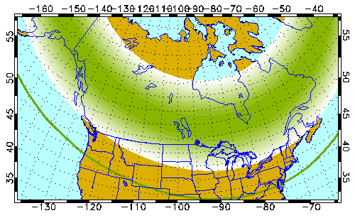
This is a bit tangential, but should be a pretty good aurora over North America tomorrow (Sat Apr 24) night -- visible on the horizon as far south as Salem, OR to Annapolis, MD: https://www.gi.alaska.edu/monitors/aurora-forecast
(forecast is for the UTC day, so the prior overnight for NA)
Answered my own question with the power of macOS preview. So the center of the outer band lies at around Newport, then continues to just south of Bend.
Cross referencing with the dark sky map, your best bet on the coast is probably around Roosevelt Beach, though the Oregon Dunes and Dismal Swamp general area also holds promise
(I have no idea how far out of the band you can be while still seeing it, they list Salem as a good viewing spot, which is much further north than the band)
Oops, update again: I called up the research institute and they informed me that the outer band is actually the line past which you cannot see the aurora, so in fact anywhere north of Newport should be good, the northernmore the better
Dark Sky communities are only one kind of designations, there are also Dark Sky "Parks" [0], "Reserves" [1], and "Sanctuaries" [2]. Those are much more scattered through the world.
I can think of several dozen places and parks in northern Scandinavia, western China, Mongolia, Canada that are almost devoid of light pollution that aren't even on this list.
Also almost the entire country of Iceland and all of its parks are excellent dark sky and not even mentioned here.
And that's just places I have personally been. I'm sure there are huge parts of Africa, Australia and the Middle East, and South America are excellent as well, and one would think that if I were to travel to those continents that I could look to a website called the "International" Dark Sky Association to find out where the best dark sky parks are in those places. But no.
It just seems a bit hypocritical to me to call it "International" but with very little attention to the wealth of excellent dark sky areas outside the US.
Oh yeah I do agree that it's still very US-centered and a tad hypocritical.
I'd say it's mostly because there is an application process. Unlike for example travel guides where people go around the world to discover new places, IDA is waiting for those places to apply. If you add the language barrier, the quite long list of requirements and political actions to make to be able to apply, that only reduces the list of candidates.
I suppose there are also less-known local initiatives throughout the world. Here in France, we have the ANPCEN [0], fighting against light pollution and delivering labels to cities that take actions against light pollution (like shutting off the streetlights from 11PM to 5AM).
Seems like the right answer. I was looking around on some maps until I found things marked SWD - which is Salt Water Disposal. Apparently the "safe" way to dispose of the used fluids from fracking.
I am grateful for this map. I used it to scout out Mojave desert as a place to do some stargazing. I was surprised that Las Vegas is still very clearly visible on the horizon, despite this being a very dark "hole" in the map.
You gotta go really far out to get dark skies all the way to the horizon.
If you don't require dark skies for 360 degrees, you can get away with going to a place that has dark sky in the direction of whatever you're trying to observe.
I've done a lot of deep sky photography within an hour of the Bay Area by being mindful of this.
How is this data collected? (I'm guessing a satellite image of city lights across the world)
I'm trying to understand the scale. Zenith means overhead, so overhead sky brightness. The magnitude scale stops at 17 but I thought magnitudes above 7 is no longer visible to the human eye [1]
this is explained in the FAQ. They merge different sources, notably data from SQMs which "stands for Sky Quality Meter. It's a small device that can measure sky quality ie. darkness. It's widely used by amateur astronomers because it's fairly cheap and gives you fast results which can be easily compared to other SQM users."
i totally get that we should save energy and make areas great for astronomers as well as give insects and birds plenty room to not be disturbed by light. BUT living in a german city is just depressing at night. you can barely see at a lot of places and its just inconvenient to walk, also everything possible is closed, there are no big 24h shops (like asda or geant, i dont mean spätshops for snacks) or anything urban or exciting i would expect in a modern city.also a lot of places have these dim and yellow orange depressing lights instead of more daylight like modern leds. can someone explain how this is a good thing?
What is fascinating to me about this is the regions including [1] in North Dakota or [2] in northern Russia (~300 km southwest of Norilsk) that have incredibly large and bright zones of light pollution -- more than many large cities -- almost entirely disconnected from population, apparently as a result of temporary natural gas extraction infrastructure.
The pollution at [1] is larger/brighter than Denver, and [2] is about equivalent to Moscow!
I'd like to get out there sometime. Even class 2 is really good for me, so we drive one once or twice a year and camp at brooks memorial state park north of goldendale. Easy to reach, has amenities nearby, still very dark. It has a good convenience/dark ratio for people coming from Portland.
I took my boy to Botswana a couple years ago, coming from the bright red on that map of the East Coast of the US. The first night I told him to look up, and it was so much fun watching his mind get blown by what he saw.
This is kind of depressing. I'm looking for a piece of land where I can get away from light pollution, and this is telling me that there is no such place anywhere near me, even out in the "countryside."
The eastern end of Prince Edward Island (Canada) comes pretty darn close to this darkness. Even though it’s sparsely populated, it’s a place that doesn’t feel isolated because of social capital.
Every time I am on a motorway in Belgium I wonder why they have such a huge amount of streetlights on highways. Maybe because it doesn't matter anymore in terms of light pollution? :D
At first, it was intended to basically burn the excess electricity produced at night by the first generation of nuclear power plants in Belgium, at a time when it was difficult to reduce their power output on demand.
From then on, because highways were always lightened up it was unnecessary to use reflective paint and signage on the highways.
And today, we're left with signage and paint that are difficult to read at night unless the highways are lined with streetlights, which makes streetlights necessary even though the power plants have been able to adapt to load for a long time now. You can really notice it on the dark sections that do exist, signage is actually difficult to see when in most other countries reflective signage is almost easier to see at night than by day.
Now the streetlights are being slowly turned off, some are being replaced with LEDs, and some of the signage is being updated to reflective, but I don't know if there's any official roadmap to eventually arrive to dark highways with reflective signage.
That article seems to point to potentially larger conflicts of interest:
The official explanation is that it helps road safety and provides security. But critics doubt this and say the phenomenon sheds light not only on Belgium’s roads but also on a mutually profitable relationship among its politicians, electricity distributors and main energy supplier, Electrabel.
My state designated a Dark Sky Park in an area that's Bortle class 4. Is the designation really that flawed? That's a shame, I was hoping to some decent stargazing in without having to drive for hours on end. Alas.
Does this tool take into account elevation? The Mt. Wilson observatory, for instance, being on the outskirts of LA, is in a red zone on that map, yet is still a great place to stargaze.
Not that this map isn't useful and insightful, but perhaps it can make things seem worse than they really are? As long as you have mountains around you, it's not like you can't go there to see the stars with the naked eye. Last year, that comet was pretty easy to see from up there.
I've camped around the Los Angles area and it is visibly bright in the mountains up to 50 miles away to the point that it feels like twilight on the horizon all night long.
World Atlas 2015 model accounts for elevation. So locations with higher elevation are darker. But it doesn't account for obstacles like a mountain range shielding you from a city behind it.
There are a lot of strange spots in Russia. I was looking at a spot south of the Pechora Sea on the light pollution map, then comparing it with Google Maps/Earth. I can't see anything that would correlate with that much light.
I checked the area I live in, it's pretty rural and has no red, except for one blob that seems to be in the middle of nowhere. So I looked it up on a satellite photo and sure enough, there's a large greenhouse operation there.
Seems odd that they'd be running their lights at night, though.
I was looking at North America as a whole, and noticed a very bright spot in Prudhoe Bay in Alaska. It's almost one of the biggest spots. Wikipedia tells me it has a population of basically 2000 people. Why is it so light?
Prudhoe is a massive oilfield. It's thousands of wells spread covering an area around 200k acres. Every well pad and facility has lighting.
Oilfields operate 24/7 so the lights are always on. Of course there's ~24 hours of daylight for half the year on the North Slope and ~24 hours of darkness in winter.
"Many farmers in North Dakota can't prevent drillers from drilling — even if they'd like to. Decades ago, the rights to the minerals below those farms were separated from the rights to the land itself — which is why today, energy companies can move in, create drilling pads where they please, move in trucks and workers, without the farmers' consent."
Am I reading this right? A company can just plop drilling operations on a farmer's land?
That's right. You can't prevent a mineral rights holder from accessing their resources - even if you hold the surface rights. The company developing the minerals has to compensate the surface owner for roads/pads/etc.
Go a little farther south and find Ft McMurray in Alberta, which isn't even traditional oil fields but oilsands excavation. Only about 70k people but it's basically as bright as the 1m people cities to the south of it (and the extra wide halo around Edmonton is likely related to refineries).
Until the invention of the electric light every night humanity communed with the stars. There's no part of human mythology or history that hasn't been influenced by a human being looking at the night sky.
We have excised this from human experience and it is a fundamental mistake. Human beings evolved with the night sky and it is criminal that we no longer have the connection.
I'm curious to know when the growing number satellites passing through your sky become a bigger problem than the light pollution?
Although, it is a qualitatively different kind of "noise" -- sparkly bright dots that fly through the dark sky periodically, versus a glow that permeates the whole sky.
So it occurs to me that this map and other light pollution maps are estimated, not measured.
The town I live in is in a valley. Go north past the mountains and it gets very dark quickly. In fact, the light is blocked significantly that I don't have to go very far to get to a dark sky.
I really like that site. Have used it multiple times to find dark spots for photographing the milky way.
However, I don't understand why the default overlay is from 2015, when there is newer data available. First thing I usually do is switching to the most recent overlay.
There are VIIRS maps and World Atlas 2015 map. They show fundamentally different things. VIIRS shows you sources of light pollution while World Atlas shows you how these sources of light impact the sky above you.
This has been a very useful website. I observed that the more "developed" a place is, more the population and inevitably a lot of light pollution. I wonder how to reduce light pollution while not bargaining with the safety at night.
I was thinking that too, and was fully expecting the top comment to be a joke about heat maps that are actually population maps, but it turns out there are some interesting insights I wouldn't have expected. Namely that there are substantial differences when comparing areas with light pollution legislation with similar unregulated areas; also interesting to see how much light pollution there is even at sea!
I like this. I think it would be also useful to add isolines for brightness of various astronomical objects to the map. I want to easily understand where I need to go to see Milky Way for example.
Neat to see the historical data in the VIIRS maps. The area around Uttar Pradesh / Bihar really seems to have developed a lot in the past 8 years, for example.
We proposed – as a counter-point to the many “light-festivals” – a festival of darkness: all the lights of the city would be off for one night. It didn’t get trough, unfortunately.
It was interesting to see that the timeline accurately reflects the changeover from sodium vapor to LED street lighting in my community. Still too much light, but better.
The map around Denver seems questionable. Same falloff in the plains to the east as in the high mountains directly to the west doesn't match my experiences.
Is it a rendering artifact or something, that the left half of the United States is entirely darker than the right half? Like a line was drawn down the middle.
Nope, just that the western US is less densely populated than the eastern side of the country and that is directly reflected in the amount of light pollution.
Same thing in the Arabian Sea. Judging by the Suez canal, these might be ships. Though I'm surprised that Ships emit as much light pollution as cities?
Is it just me, or does his look quite a lot like a population density heat-map? XKCD 1138[1] comes to mind.
For those persons concerned solely about light polution, this is definitely useful. But another thing I think would be interesting is this map, corrected for population density. Mentioned down thread is that different localities have different rules affecting lighting, and that this can be seen in the map. Correcting this map for population density would probably show that even more.
i remember a long time ago i was told north korea was a dark spot on earth when viewed from space, interesting to see it on an actual light pollution map. not that north korea is alone in this aspect.
Certainly not. See the other comments about light pollution from heavy industries (oil, etc), and also countries with lower-than-expected light pollution compared to their population, due to laws (Germany)
In general yes, though just looking quickly, it seems like Belgium for example was a lot brighter than surrounding countries, and I don't think they have that high of a density?
I would liked to see a map like this normalized for population density, though not sure how granular that data is.
Belgium has a pretty high population density: 375/km². That's the 9th most densely populated country of the world. And that is mostly because of Flanders, the part that is actually lit up on the map. Flanders has a population density of 484/km².
The site appears to be using OpenStreetMaps based on the font. But I don't see any attribution to OSM anywhere on the site? It's a part of the agreement to use OSM...
For example, upstate New York has some great viewing locations, so even if you live in NYC it's an easy weekend trip. Here's a shot I took of the Milky Way taken from such a site (one of the darker spots in the map): https://www.lumathon.com/photo/_qTYviEhy/Colors-of-the-Milky...
Edit: a few more of my other shots of the night sky for anyone interested, various locations, all of which were scouted using a light pollution map like the one posted -- https://www.lumathon.com/dan/photos/tag/stars